"Delineation of the Jameson Family Cemetery, Pickens County, South Carolina," LAMAR Institute Publication Series, Report Number 141, The LAMAR Institute, Inc., 2009
2009 GPR Report Summary
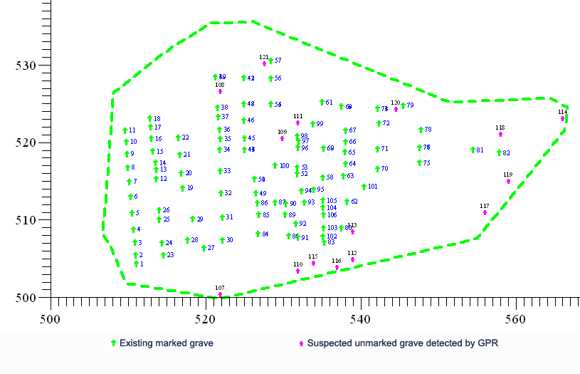
The LAMAR Institute researchers were employed by the Jameson Family Cemetery, Inc. to delineate the Jameson Family Cemetery in rural Pickens County, South Carolina. Fieldwork for this two-day project was completed on February 6, 2009. The survey was accomplished by transit mapping, grave documentation, and Ground Penetrating Radar (GPR) data collection. The data was post-processed in the lab using multiple software programs. The results include a series of scaled maps that show various features within the cemetery, a set of digital photographs of the grave markers, tabular data on the graves identified by surface markers and historical search, and GPR radargrams, plan maps and animated jpeg maps of the subsurface of the cemetery. These lines of evidence were integrated to create a more complete story of the cemetery and its contents. Out of the total of 121 graves identified in the cemetery, 15 unmarked graves were detected by GPR (Figure 29). This study represents the first documented use of GPR technology to define cemeteries in Pickens County, South Carolina. GPR proved to be a highly effective and useful tool in documenting the Jameson Family Cemetery.
A brief reconnaissance visit to the Freeman-Fowler-Jameson Cemetery, which is located within a few miles of the Jameson Family Cemetery, also was conducted by the LAMAR Institute team. Only one hour was spent in this effort, however, so the findings were quite limited. Field conditions in the wooded setting also restricted the GPR survey that could be accomplished. More fieldwork is recommended to properly delineate this historic cemetery. [Note: The report is being reviewed by Jameson Family Cemetery, Inc. and a few minor corrections to the text will be supplied.]
Selected Report Figures and other photos:
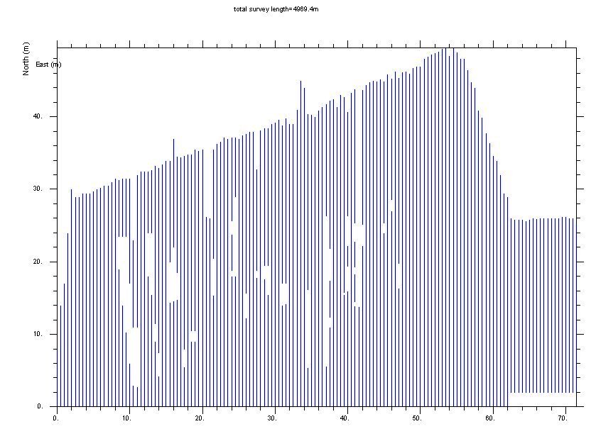
Figure 3. GPR Survey Transect Coverage of Jameson Family Cemetery
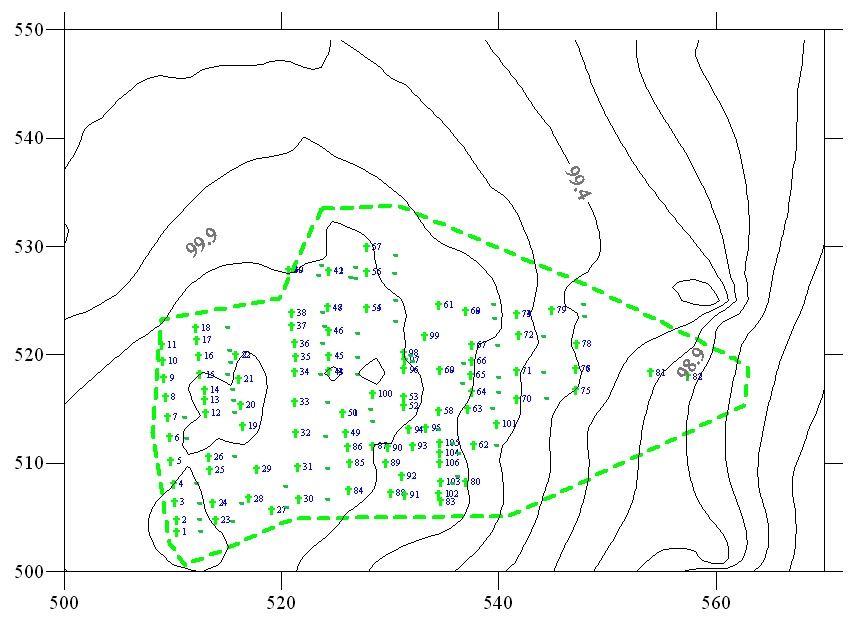
Figure 5. Headstones and Footstones and Site Topography, Jameson Family Cemetery
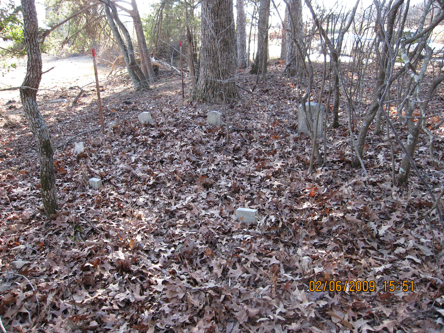
Figure 14. Southwestern View of Freeman-Fowler-Jameson Cemetery (from left to right are the graves of Joshua, Elizabeth Rebekah, and Elizabeth Fowler).
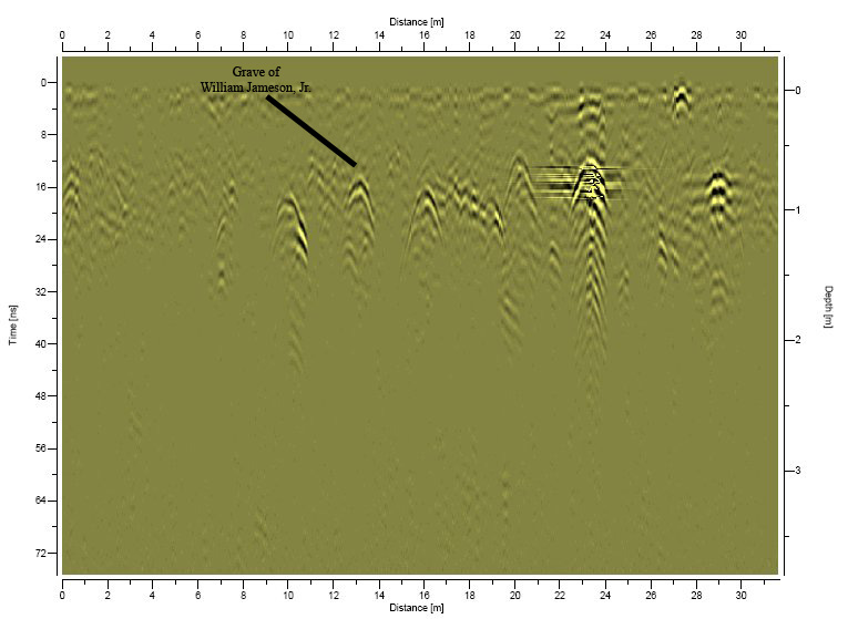
Figure 18. GPR Radargram DAT_0064, Which Shows the Profile of William Jameson, Jr.'s Grave and Five or More Others (500-532.5 North, 523 East)
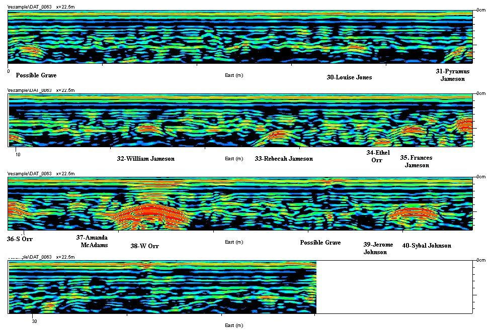
Figure 21. Radargram DAT-0063(500-536.6N, 522E)
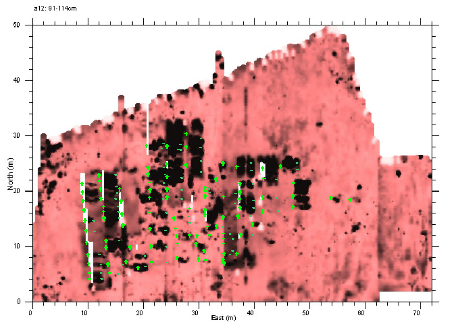
Figure 27. Map of Jameson Family Cemetery, Showing Gravestones Superimposed on the GPR Plan Map
Figure 29. Distribution of Marked and Unmarked Graves, Jameson Family Cemetery
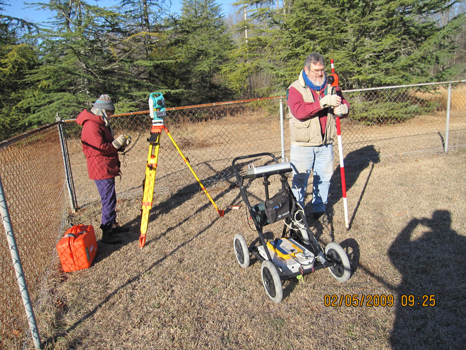
Photo of investigators Dan and Rita Elliott setting up the grid and GPR apparatus on Februray 5, 2009
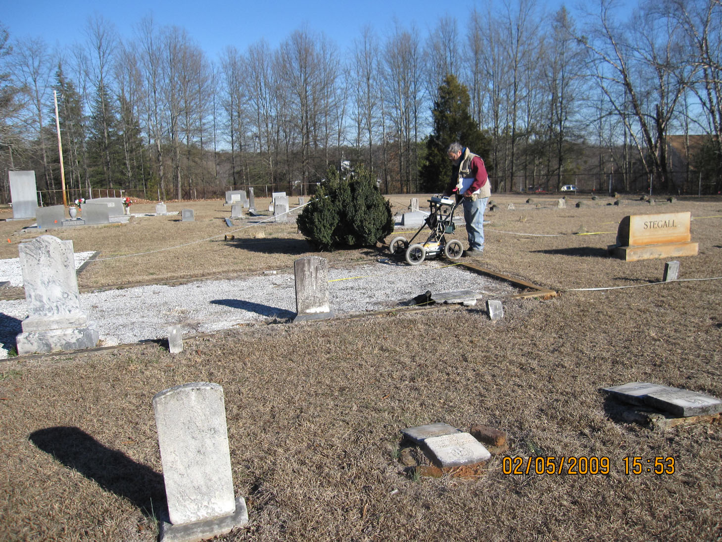
Dan Elliott guiding GPR apparatus along nouth-south transect near the center of the cemetery
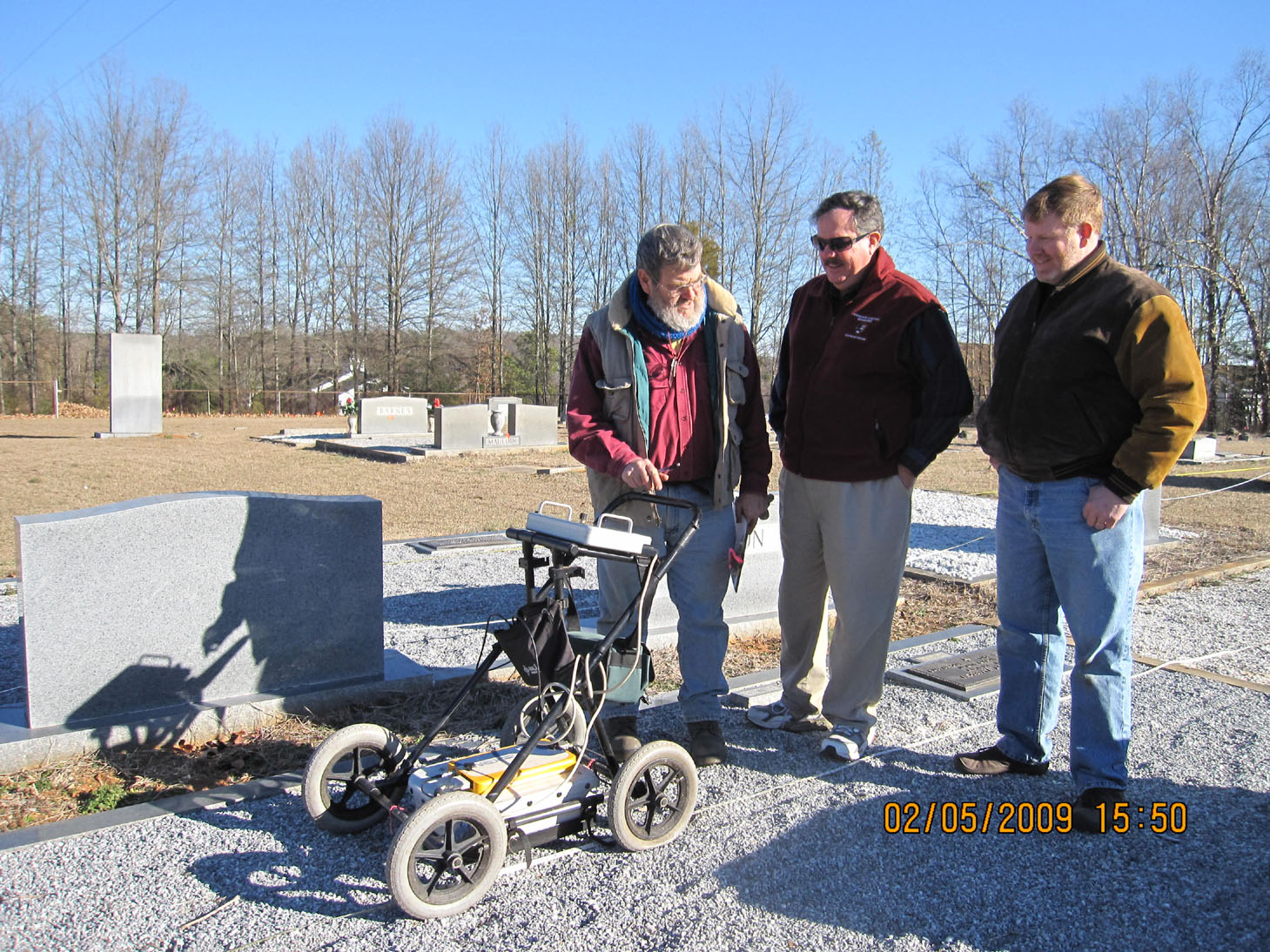
Photo of Dan Elliott explaining GPR instrument readings to volunteers John Jameson and Michael Johnson
Table 1. Jameson Family Cemetery Inventory, List of Graves Recorded (PDF)
Download Complete Report PDF (10.134 MB)